Drought in New Mexico
- OSE Home
- Drought in New Mexico
- Precipitation/Reservoir/Streamflow Data
Precipitation/Reservoir/Streamflow Data
Precipitation Data
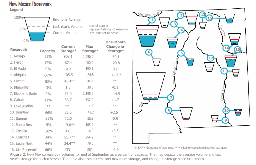
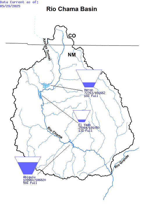
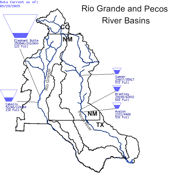
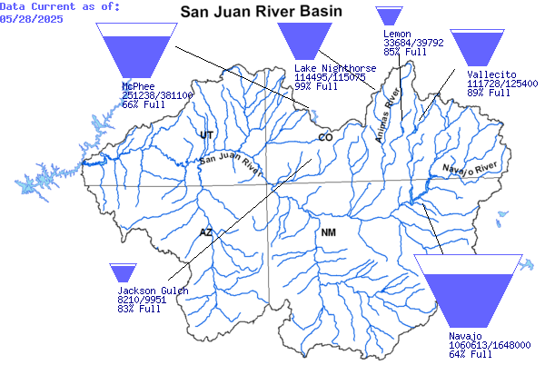
Current Reservoir Levels
![]()
Courtesy of CLIMAS - Climate Assessment for the Southwest
US Army Corps of Engineers – Streamflow and Reservoir Data
Updated every 24-hours
Courtesy of U.S. Department of the Interior Bureau of Reclamation
![]() Normally daily reports are available by the 10:00 AM of the following workday. Currently, daily reports are available for the latest two to six weeks basedon the availability of the monthly reservoir reports. Once the monthly reports are posted, the associated daily reports are remove.
Normally daily reports are available by the 10:00 AM of the following workday. Currently, daily reports are available for the latest two to six weeks basedon the availability of the monthly reservoir reports. Once the monthly reports are posted, the associated daily reports are remove.
Courtesy of the US Army Corps of Engineers
Streamflow USGS
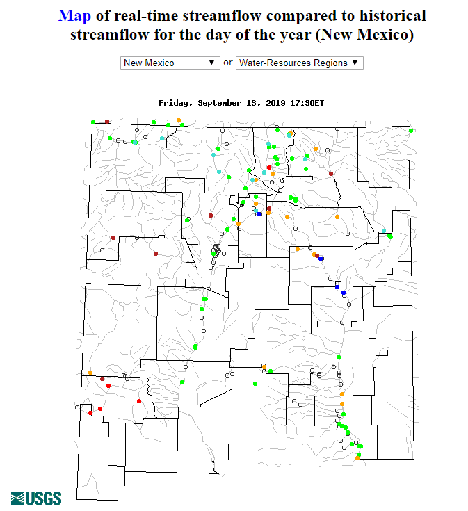
Image Courtesy of the USGS
New Mexico Office of the State Engineer Real-Time Water Measurement System
The New Mexico Office of the State Engineer/Interstate Stream Commission (OSE/ISC) engages in Active Water Resource Management (AWRM). This allows the State Engineer to actively manage the state's limited water resources while administering water rights and interstate compacts throughout the state. In order to do this, the OSE/ISC maintains a network of stream, acequia, ditch and well monitoring sites that electronically transmits data values via radio and satellite telemetry and stores the data in a database. This real-time water measurement data is available for each active gage/well shown on select basin maps.