Canadian River Basin
Canadian River Commission - 2024 Annual Meeting Announcement
The Canadian and Dry Cimarron basins encompass much of the northeastern quarter of the state, about 17,066 square miles, or 14 percent of the land in New Mexico. The basins cover varied terrain, from the southern Rocky Mountain chain of the Sangre de Cristo Mountains, the crest of which marks the basins’ western boundary, to gently sloping plains in the eastern part. The northern part of the basin consists of basalts and cinder cones, characteristic of ancient volcanic activity. Elevations in the southern Rocky Mountains may exceed 12,000 feet, and elevations in the eastern plains range from 7,350 to 3,600 feet.
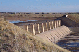 Through this large and diverse region, the Canadian River flows from the north, collects easterly-flowing tributaries draining the highlands on the west side of the basins, and then flows to the southeast and east, past Conchas and Ute Dams, into Texas.
The Canadian and Dry Cimarron basins include parts of northern San Miguel, Guadalupe, Quay, and Curry Counties and all of Colfax, Union, Mora, and Harding Counties. Population centers include, Raton, Springer, Eagle Nest, Clayton, Tucumcari, Mora, Wagon Mound, Conchas Dam, and Logan. In 2000, the total population in the basins was approximately 35,000.
The basins include all of the Colfax Water Planning region and parts of the Northeast New Mexico Water Planning region and the San Miguel/Mora/Guadalupe Water Planning region.
The Canadian River Compact among New Mexico, Oklahoma, and Texas was signed in 1950 and approved by the parties in 1952. The compact apportions water among the states on the Canadian River and provides for a commission to administer its provisions with one commissioner for each state and one for the United States.