Water Planning
- OSE Home
- About Water Planning
- RWP
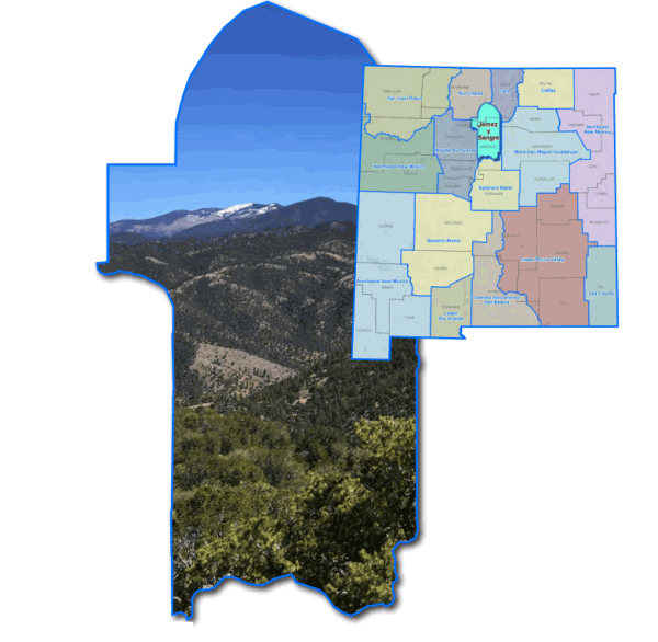
- Region 3 - Jemez y Sangre
Region 3 - Jemez y Sangre Regional Water Plan
2016 Jemez y Sangre Regional Water Plan
2003 Jemez y Sangre Regional Water Plan
The water planning region encompasses Los Alamos County and portions of Santa Fe and Rio Arriba Counties. The principal river basin is the Rio Grande. The major aquifer is the Teseque Formation (Santa Fe Group)
The region is bounded on the north by the ridge above the Rio Embudo, a tributary of the Rio Grande, and by the Espanola City Limits; on the west by U S. Highway 285 and Sandoval County; on the south by the northern boundary of the Estancia Underground Basin in Santa Fe and Torrance counties, and on the east by San Miguel, Mora and Taos Counties.